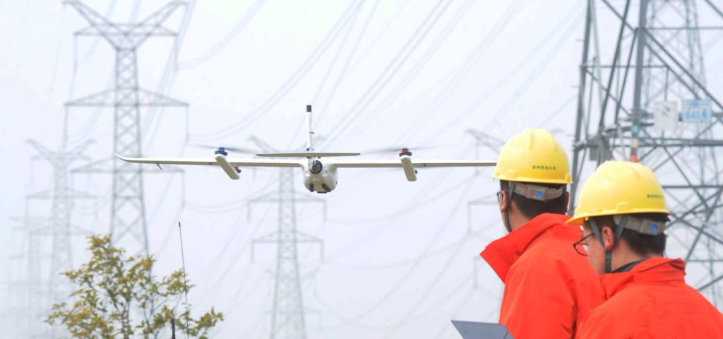
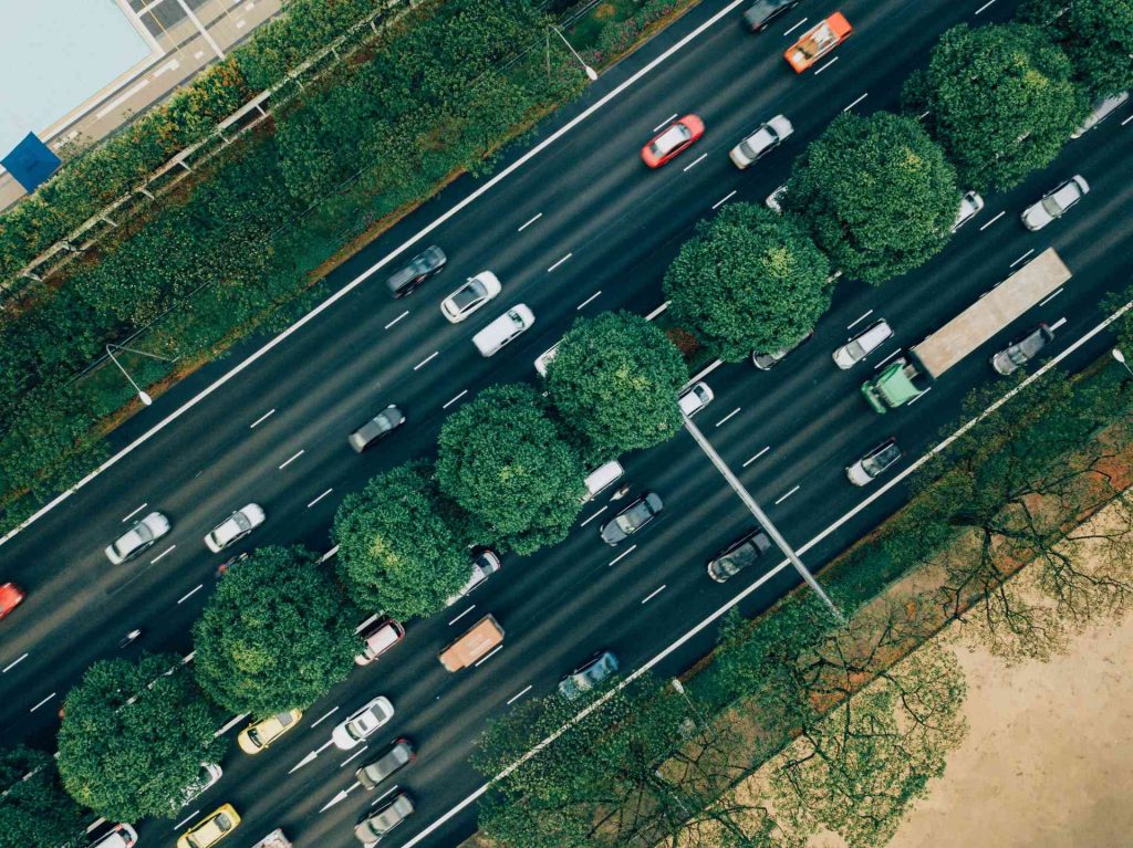
Equipped with high-definition digital video cameras, GPS systems, and advanced imaging technologies, drones can perform autonomous flights along power grids, capturing real-time footage and images. This allows operators to monitor and manage power lines efficiently from a computer. Fixed-wing drones, like the JOUAV CW series, offer extended flight durations of up to 8 hours and extended radio links covering up to 100 km, significantly enhancing efficiency compared to traditional manual inspections. These drones drastically reduce costs associated with manually locating power line faults, making inspections more efficient and safer. In emergency situations, such as earthquakes or floods, drones can assess structural integrity without endangering human lives. They can also cover hard-to-reach areas and provide critical data for restoring power supply swiftly. For instance, read more about how VTOL drones helped Guangdong Power Grid boost inspection efficiency tenfold. Integrating drones into urban traffic management optimizes both macro-level planning and micro-level monitoring. By offering flexibility, affordability, and stability, drones play a pivotal role in creating a three-dimensional traffic system encompassing water, land, and air. This ensures smooth traffic flow, timely incident responses, and effective emergency rescues. Drones are highly effective tools for law enforcement, addressing issues of blind spots and delayed evidence collection. Their mobility and precision make them ideal for monitoring road conditions, managing traffic violations, and handling accidents. Drones can quickly capture clear images of incidents, aiding authorities in determining liability and ensuring swift recovery of traffic flow. Drones are widely used in environmental monitoring, broadly categorized into three types: observing air, soil, vegetation, and water quality; conducting real-time tracking of sudden pollution events; and enforcing environmental regulations by monitoring factory emissions and wastewater discharges. Equipped with advanced sensors, drones provide all-weather aerial monitoring,ä¸å—地形é™åˆ¶, and offer timely data for environmental enforcement. They are particularly useful in smog-prone regions where they can identify pollution sources promptly, helping mitigate environmental harm. Drones are instrumental in aerial photography for resolving territorial disputes and confirming land ownership rights. UAV remote sensing technology has proven its effectiveness in land rights confirmation worldwide. The technology is accurate and significantly cuts down on time and resource expenditure compared to traditional methods, making it a valuable tool in this field. Integrating drones with high-definition cameras and sensors helps insurers accurately measure crop areas and assess risks, ensuring fair compensation for farmers affected by natural disasters. With frequent natural calamities threatening crops, drones help insurers verify damages quickly and efficiently, ensuring timely payouts and enabling farmers to take preventive measures to minimize losses. Drones capable of carrying packages smaller than shoeboxes can transport goods directly to recipients via GPS addresses. Drone delivery is especially beneficial in Tier 4 and Tier 5 cities where ground logistics infrastructure is limited. With just a small drone port, high-speed logistics can be established without the need for extensive airport facilities. Equipped with HD cameras, drones provide aerial images of disaster zones, aiding in rapid rescue efforts. Drones can cover vast areas quickly, providing real-time data to guide rescue teams, identify key areas, and select safe routes. They also monitor ongoing disasters, preventing secondary incidents. Drones are used extensively in mapping and surveying for land resources, geological exploration, and emergency situations like earthquakes and mudslides. Fitted with thermal lenses, drones detect fire sources early, reducing patrol costs significantly. Thermal drones provide essential real-time data to firefighters, helping them combat fires more effectively. Using drones for large-scale aerial photography provides unique bird's-eye perspectives. For areas perpetually shrouded in fog, drones offer an alternative to satellite imaging, capturing detailed street views. High-definition drones enable filmmakers to capture stunning aerial footage remotely. From Hollywood blockbusters to Olympic events, drones have revolutionized filming, offering cost-effective and versatile solutions. Unmanned aerial vehicles (UAVs), commonly known as drones, operate either autonomously or through remote controls. They excel in dull, dirty, or dangerous tasks. Applications range from aerial photography and agriculture to disaster relief and filmmaking, expanding drone usage globally. Variable valve timing (VVT) solenoid or oil control valve controls the oil flow according to the engine speed and load. VVT solenoid is a vital part of the variable valve timing system. Variable Valve Timing Control,Vvt Valve Sensor,Timing Control Valve,Vct Solenoid F150 5.4 Wenzhou Zhongking Parts Co.,ltd , https://www.oemvvt.com1. Power Line Inspection
Why Recommended:
2. Traffic Management
Why Recommended:
3. Environmental Protection
Why Recommended:
4. Land Rights Confirmation
Why Recommended:
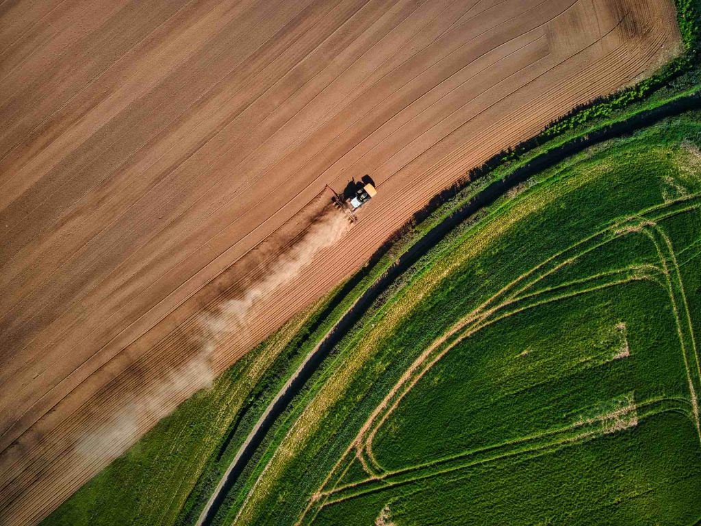
5. Agricultural Insurance
Why Recommended:
6. Express Delivery
Why Recommended:
7. Post-Disaster Relief
Why Recommended:
8. Remote Sensing and Mapping
9. Forest Fire Prevention
Why Recommended:
10. Street View Photography
Why Recommended:
11. Filmmaking
Why Recommended:
Exhibition Information
The Oil Control Valve (OCV) is a a critical part used in every engine that is fitted with variable valve technology (VVT). A single control valve will regulate the supply of oil to a designated VVT hub, to advance or retard the timing by altering the camshaft angle position. Controlled by the ECU, the OCV receives electrical signals, instructing it to adjust the oil flow as required, in accordance to current driving conditions.
What Are the Main Applications of Drones?
Next Article
What Are the Main Applications of Drones?
Prev Article
An Overview of Gravel: Composition, Uses, and Types